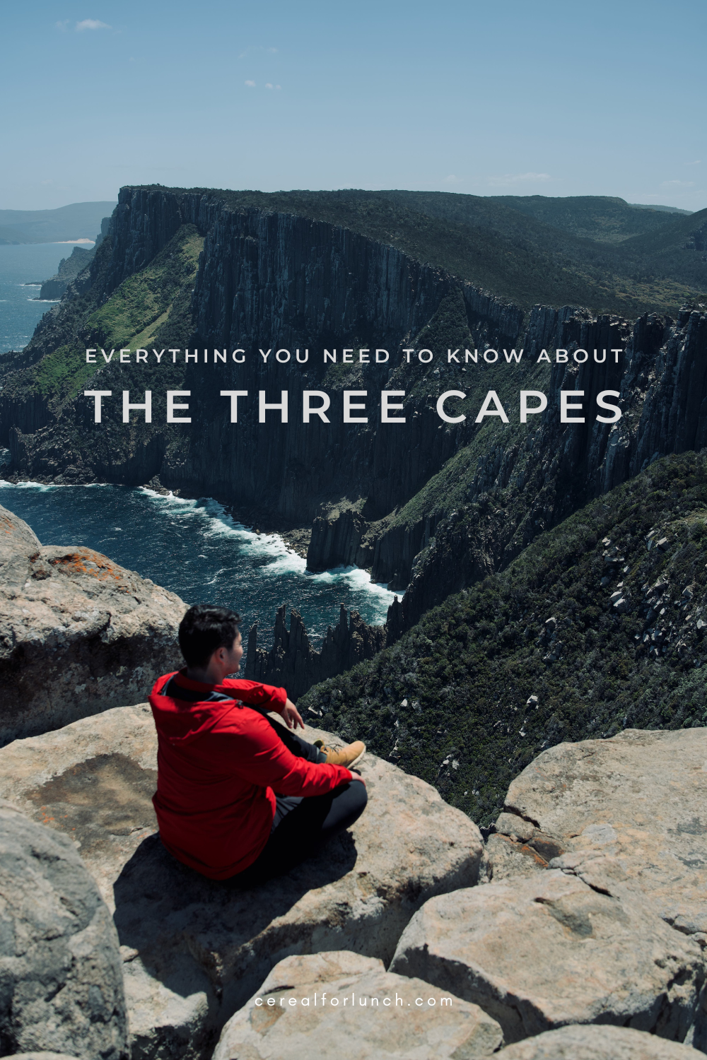
Everything you need to know about Tasmania’s Three Capes Track
by ling and jace (updated June 2023)
The Three Capes Track passes through Pydairrerme land. We acknowledge and pay our respects to the Traditional Owners.
home / back to australia

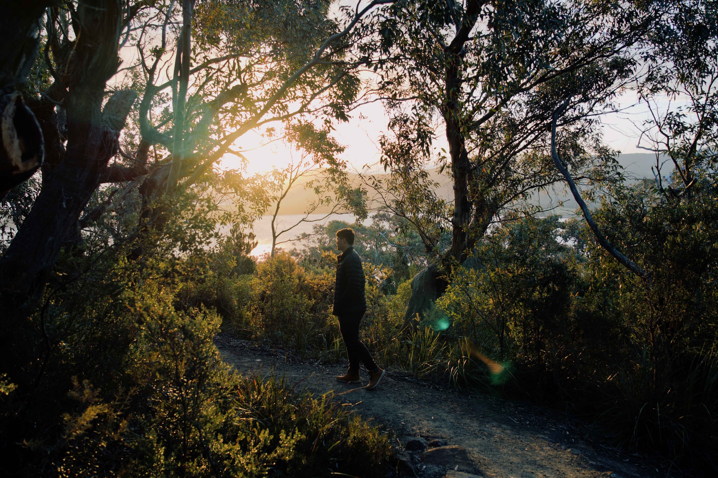
The Blade and Cape Pillar, Day 3
Sometimes we stop to meditate and it takes a bit of time to completely slip into it. But on other days, we are so deeply present that each experience feels meditative. On our hike across the Three Capes, Pydairrerme land, every-day meditations came naturally—from walking under an early moonrise, feeling ocean mist on our skin, reflecting on what gives warmth to life, and freezing for a chance to catch the Milky Way.
Over four days, we followed the track for 48km around the Tasman Peninsula. There is plenty of time to get to the next cabin, so we could really stretch out each day and take it all in.
Top of The Blade, Day 3
EVERYTHING YOU NEED TO KNOW ABOUT THE THREE CAPES TRACK
This post includes everything you need to know about hiking the Three Capes Track:
HOW HARD IS THE THREE CAPES TRACK?
The Three Capes Track was our first multi-day hike, and we found it to be a very approachable trail, suitable for all levels of fitness. We hiked with Ling’s entire family (aged from 20 to 60, none with any multi-day hike experience), and shared the trail with lots of people and children who had different levels of hiking experience. For many, it was also their first multi-day hike.
The accommodation is comfortable, the track is well-maintained, and the views are breathtaking. It’s marked as an ‘easy’ trail (Grade 3), and the majority of the track is either clear or built up with board walks. It also helps that some of the steeper sections are optional detours, and that there are places to leave your packs along the trail on the third and fourth days.
However, we would say that while the track is clear and stable, we still found the hike can be tiring with the weight of the packs. We’ve included a full breakdown of what to expect on each day of the hike below, but the third and fourth days are definitely the steepest.

Boardwalk on the way to The Blade and Cape Pillar, Day 3

Dolerite island seen from the top of Cape Pillar, Day 3
HOW TO BOOK THE THREE CAPES TRACK
There are several options for hiking the Three Capes Track, from tours to a self-guided walk.
BY TOUR (CARRYING A DAY PACK)
Tours are a convenient option if you want to see the Three Capes Track but don’t want to carry all of your gear, food and camping equipment, as they return to the same accommodation each night. These are the two best options that we could find, which also include transfer from Hobart and all meals:
Three-day off-peak hiking trip: this covers most of the track over three days of hiking. It returns to the Three Capes and Tasman Lodge in Port Arthur, so you don’t need to carry any sleeping or night gear.
Four-day walking tour: this includes four days of hiking along most of the Three Capes track. It also returns to the Three Capes and Tasman Lodge in Port Arthur each night and includes a wilderness and wildlife cruise around the peninsula on the last day.
SELF-GUIDED
Alternatively, you can hike the Three Capes continuously across four days and stay in accommodation on the track itself. Passes for the self-guided Three Capes Track need to be booked well in advance. The pass includes transport to and from the trail (by ferry on the way there and bus on the way back), three nights’ accommodation in eco-lodges, and complimentary entry to the Port Arthur Historic Site that is valid for 2 years. Once you arrive at the beach on the first day, it’s a self-guided trail which accommodates up to 48 people a day.
The track and accommodation are run by the Tasmanian Walking Company in partnership with Tasmanian Parks and Wildlife Service. In 2022, the Tasmanian Walking Company was one of six finalists in the Banksia Foundation’s Sustainable Tourism Awards.
While the trail and facilities are incredible, passes are admittedly expensive. From 1 July 2023, passes for adults cost $595 (AUD) and passes for children and concessions cost $476 (AUD). Alternatively, it is possible to do sections of the trail as a day hike and separate to the Three Capes Track. We've listed these at the end of this article. However, we’re really glad that we experienced the full multi-day hike, and the accommodation and maintenance provided to the area definitely made the pass worth it.
ACCOMMODATION AND FACILITIES ON THE THREE CAPES TRACK
For the tours mentioned above (three-day off-peak hiking trip and four-day walking tour), the tours return to the Three Capes and Tasman Lodge in Port Arthur each night.
For the self-guided walk, the Three Capes Track is one-way, and each night is spent at a different cabin. Each cabin has shared dorm rooms with bunk beds and mattresses that accomodate up to 8 people. The rangers try to ensure that groups that are walking together share the same dorm, but you may end up sharing a room with other hikers. If you’re hiking with friends on a separate booking, we’d recommend contacting rangers ahead of time to let them know.
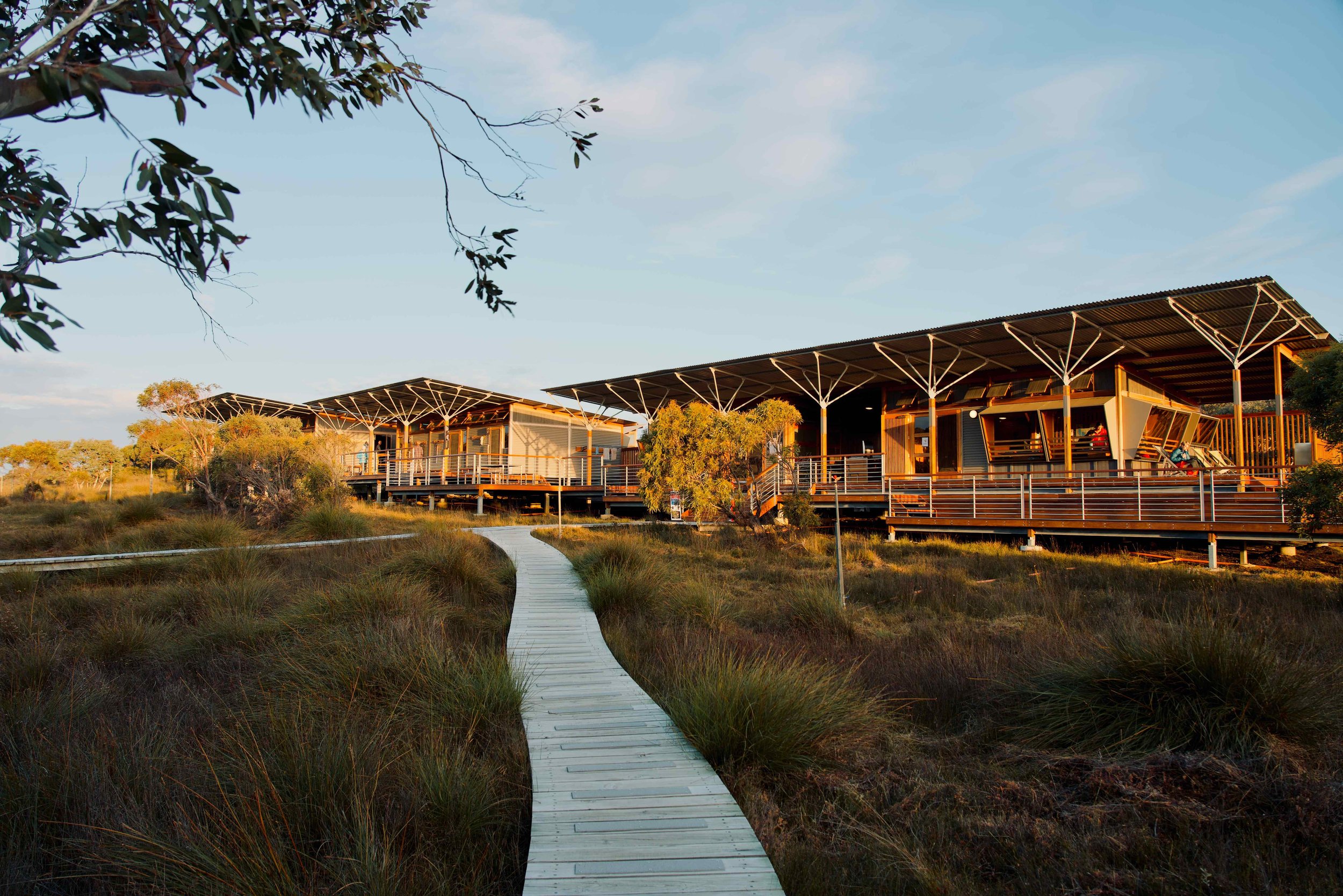
Each cabin site also has shared kitchen and chemical bathroom facilities that are well cleaned. All of the kitchens contain gas cooktops, pots, pans and cooking utensils (but not cutlery), cleaning equipment, power points and usb charging stations, tables, benches, and heating. The first nights’ cabins also has barbeques. Hot water is only available for outdoor showers on the second night, and it’s a bucket of water in a rope-hoisted bag kind of deal. The cabins were simple but very clean and comfortable. They are surrounded by beautiful natural landscapes, with ocean views and gum trees. A host ranger stays at the cabins each night and provides a debrief on the cabins and what to expect on the next days’ hike.
NIGHT ONE - SURVEYORS HUT
Surveyors Hut was a comfortable first-stop on the Three Capes, especially because of the huge decks and ocean view. There are two separate kitchens at this hut, and a barbeque area, so it doesn’t feel crowded in the common areas. You might also have phone reception here.
Surveyor’s Hut, Day 1
NIGHT TWO - MUNRO CABIN
We’d really recommend catching the sunrise or sunset from the helicopter pad near the cabins at Munro. This cabin is also the only one that offers hot water for an outdoor shower, so pack a light-weight towel.
View from Munro Cabin, Day 2
NIGHT THREE - RETAKUNNA CABIN
Retakunna Cabin is surrounded by gum trees, and is the best place to see wallabies, echidnas and black cockatoos. We’d recommend leaving a little earlier on the last day so you have enough time for the climb up the hill.

Retakunna Cabin, Day 3
BEST TIME OF YEAR FOR THE THREE CAPES TRACK
Compared to other parts of Tasmania, the Three Capes Track is more moderate because of the water that surrounds it on three sides. In summer, the maximum temperature is around 16-19°C, and 10-12°C in winter.
We planned our hike at the end of December and were lucky to see clear blue skies, wildflowers in bloom, and very little rain (only light showers on one afternoon). One benefit of doing the hike at the end of the year (around Christmas/New Years) was that there weren’t many other people on the track, with about half the number of hikers as in peak times. This four-day walking tour runs in summer.
In autumn (March - May) and spring (September - November) whales migrate along the coast and can be seen from wildlife cruises around the Tasman Peninsula. Rangers along the way told us that it is still fine in winter (especially as the kitchen areas of the cabins are heated), but because of how cold it can be, it is usually a much quieter time of the year.
WHAT TO PACK FOR THE THREE CAPES TRACK
If you’re taking one of the tours mentioned above (three-day off-peak hiking trip or four-day walking tour), they both return to the Three Capes and Tasman Lodge in Port Arthur each night. On these tours, there is no need to to carry all of the sleeping gear or food for the full four days, as you can pack for each day separately.
If you’re planning to hike the Three Capes in four days and stay in the trail accommodation, check the Three Capes Track packing list for everything you need to bring. This is what we took for the four days:
BACKPACK AND HIKING GEAR
Between the two of us, we took one 55L backpack and one 65L backpack and made sure they had rain covers. Altogether, our backpacks weighed 10kg and 13 kg. On the third and fourth day you can leave your backpacks for part of the trail, so we also took a compact day pack which folded up. We’d also recommend taking hiking poles as it helps to distribute the weight evenly, especially while going uphill.
CLOTHING
We tried to limit the amount of clothing that we took, but it is important to pack for all weather conditions. We’d recommend a light layer (activewear) during the day, a compact puffer or fleece jacket/pants (with an optional beanie and gloves) for nights, and rain and wind proof gear just in case. A spare change of clothes and comfortable slippers can also be good after a whole day of hiking.
FOOD AND WATER
The kitchens in the cabins are well-equipped with gas stoves and cooking utensils. You’ll need to bring enough food for four days, as well as light-weight cutlery, including plates/bowls, forks, knives, etc. Our main food for breakfast was oats mixed with cinnamon and fruit. For lunch, we packed things like salami, bread, jerky, fruit, protein bars (Quest bars are pretty dense and can help blunt your appetite throughout the day) and nuts. For dinner, we mostly relied on dehydrated food packs and rice. We’d recommend taking a 1.5 - 2L bottle of water per person, which can be filled at the cabins. Fruit will keep for the duration of the hike and is a good source of hydration, but they can also add a lot of weight to your pack.
WASTE
The cabins have composting bins for food waste, but all other rubbish needs to be taken out with you. We carried two waterproof dry bags lined with plastic bags for non-compostables.
SLEEP
The cabins have thick, comfortable mattresses on bunk beds, so the only thing that is really necessary is a sleeping bag. If you want, you could also take an inflatable pillow. We’d recommend packing a head torch as there is no light inside the cabins themselves.
TOILETRIES AND FIRST AID
Alongside regular toiletries, we’d recommend taking lightweight microfibre towels (we took one for drying cutlery and dishes, a larger one for showering, and a tiny one for face washing). A small shovel and toilet paper also comes in handy when nature calls.
Our first aid pack included things like compression bandages, bandaids, antiseptics, insect repellant and bug bite sticks, basic painkillers and antihistamines, and hydralyte.
Part of the Three Capes Track around Surveyor’s Hut, Day 1
WHAT TO EXPECT ON EACH DAY OF THE THREE CAPES TRACK
The Three Capes track covers 48km over four days. The route between the cabins gets steeper and longer each day, but luckily the views also get better along the way.
We’ve listed times below to help gauge how long each day may be. But we really don’t think it matters how long you take to hike between cabins on days 1, 2 and 3. The cabins will always be there, so it’s more important that you take the time to enjoy the hike, views and wildlife between the cabins on those days. The last day is the only exception because you need to make a scheduled bus time, but otherwise, enjoy the days for what they are and just aim to get to the next cabin before the sun sets.
DAY ONE
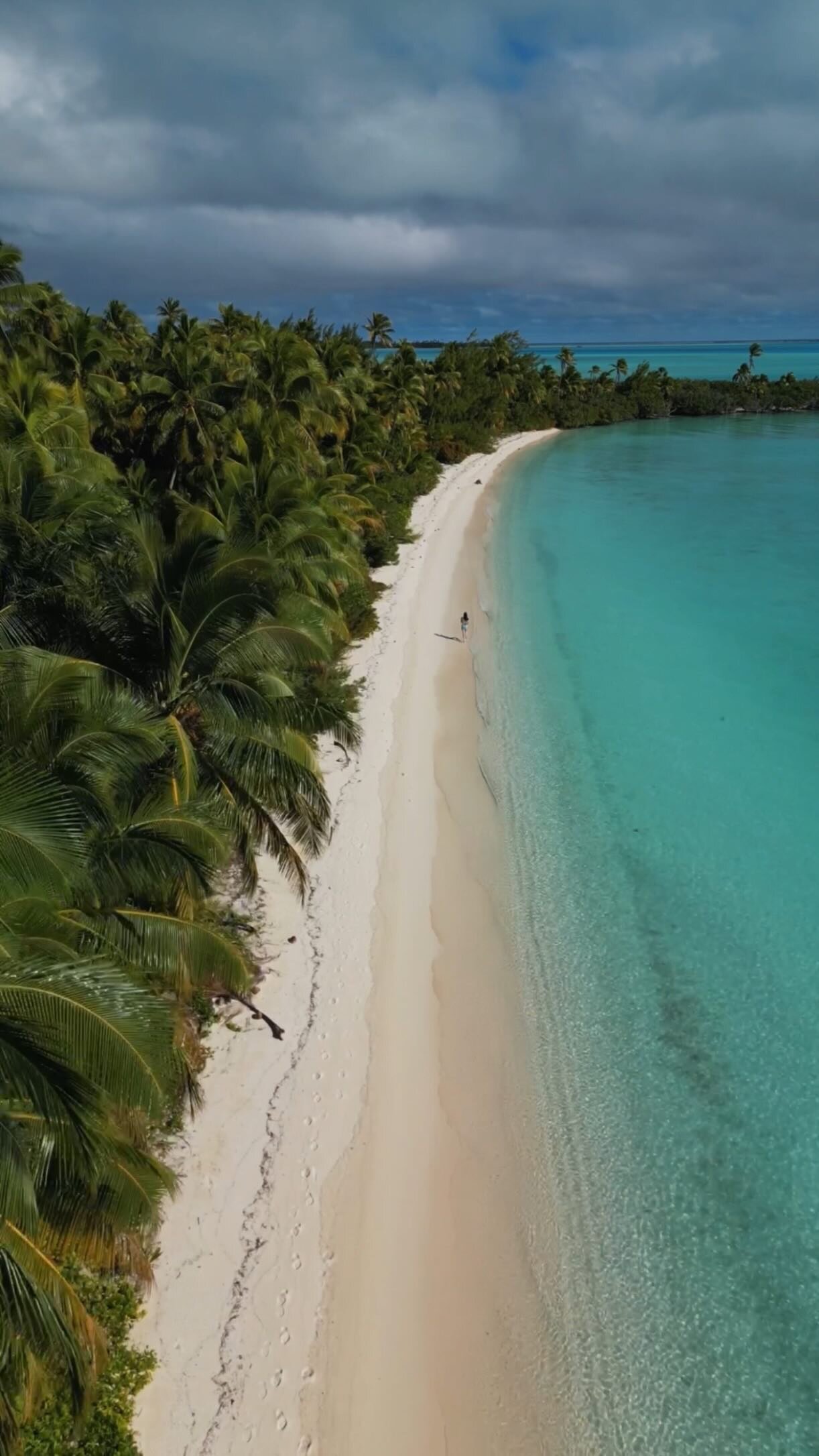
DENMANS COVE TO SURVEYORS HUT
DISTANCE: 4KM
TIME: ~2.5HRS
The Three Capes Track starts on a secluded beach in Denmans Cove, with ferries travelling twice a day from the Port Arthur Historic Site. It’s pretty common for hikers to explore the Port Arthur Historic Site before they leave, so if you’d like to do so, they recommend allowing an extra 60-90 minutes before the scheduled ferry time.
Our first view over the water was beautiful. We were followed by a large pod of dolphins, and caught glimpses of the rock formations and bird all along the capes. When the boat arrives at Denmans Cove, you may need to walk through water to get to the beach (they try to go as close as possible, but it really depends on the tide). When we got there, the water was around knee deep, and we took off our shoes and carried our packs a short way to get to the shore.
The hike to the first hut is then 4km, which took us around 2.5 hours. It’s the shortest day of the track and mostly flat, but also the heaviest with all of the food you’ve packed. If you eat meat and are up for carrying the weight, you can bring some to eat on the first night as they have barbeques at the cabins.

Dolphins on the way to Denmans Cove, Day 1

Dolerite rock formations seen from the ferry to Denmans Cove, Day 1

Surveyor’s Hut, Day 1

Wallaby seen on the Three Capes Track, Day 1
DAY TWO
SURVEYORS HUT TO MUNRO CABIN
DISTANCE: 11KM
TIME: ~4.5HRS
The second day of the Three Capes Track is the first full day of hiking along the coast. After leaving Surveyors Hut, you’ll make a short climb up Arthurs Peak and be rewarded with spectacular views across Crescent Bay and Cape Raoul. The trail continues through a beautiful eucalyptus gum forest, and then fields of wildflowers when you reach Ellarway Valley. As you pull up to Munro Cabin, you’ll be greeted with an incredible view of Munro Bight and Cape Hauy to end the day.
On our hike, a lot of people left Surveyors Hut before 8:00am and made it to the next cabin in less than the 4.5hrs. We didn’t feel the need to leave early, and instead took our time to have breakfast. We were the last to leave the cabins at around 9:30am, and stopped several times to take photos, enjoy the scenery, see wildlife, and have lunch. We sat with wildflowers for an hour, watching black cockatoos flying over Ellarway Valley, and arrived at Munro around 4:00pm with plenty of daylight left to have a shower, relax, and take in the views before dinner.
Some people who start Day 2 early also opt to continue onto the Blade and Cape Pillar (which you otherwise reach on Day 3). This takes the total distance traveled on Day 2 to 30km. We didn’t do this, but can imagine the sunset lighting over the coast around the Blade and Cape Pillar would make for a completely surreal experience.

Arthurs Peak climb, Day 2
Three Capes Track, Day 2
Ellarway Valley, Day 2

View from Munro Cabin, Day 2
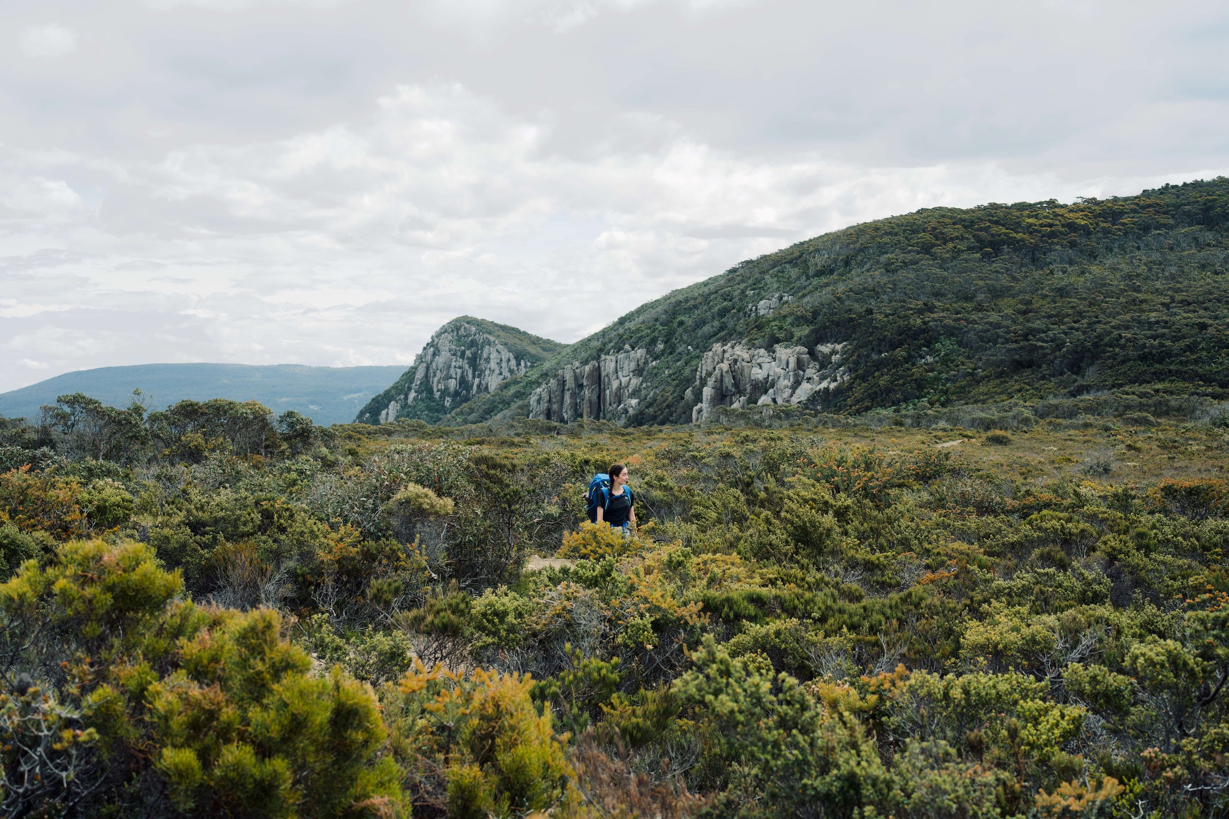
DAY THREE
MUNRO CABIN TO CAPE PILLAR TO RETAKUNNA CABIN
DISTANCE: 19KM
TIME: ~6HRS
The third day of the Three Capes Track includes the highest coastal cliff tops in all of Australia. It’s the furthest day, but it’s a comfortable hike starting with boardwalks in the forest, and then a well-maintained coastal trail. There’s a small shack around the corner from Munro Cabin where you can leave your hiking packs (you’ll return to pick it up on the way back), so we recommend carrying a smaller day pack for food, water and first aid.
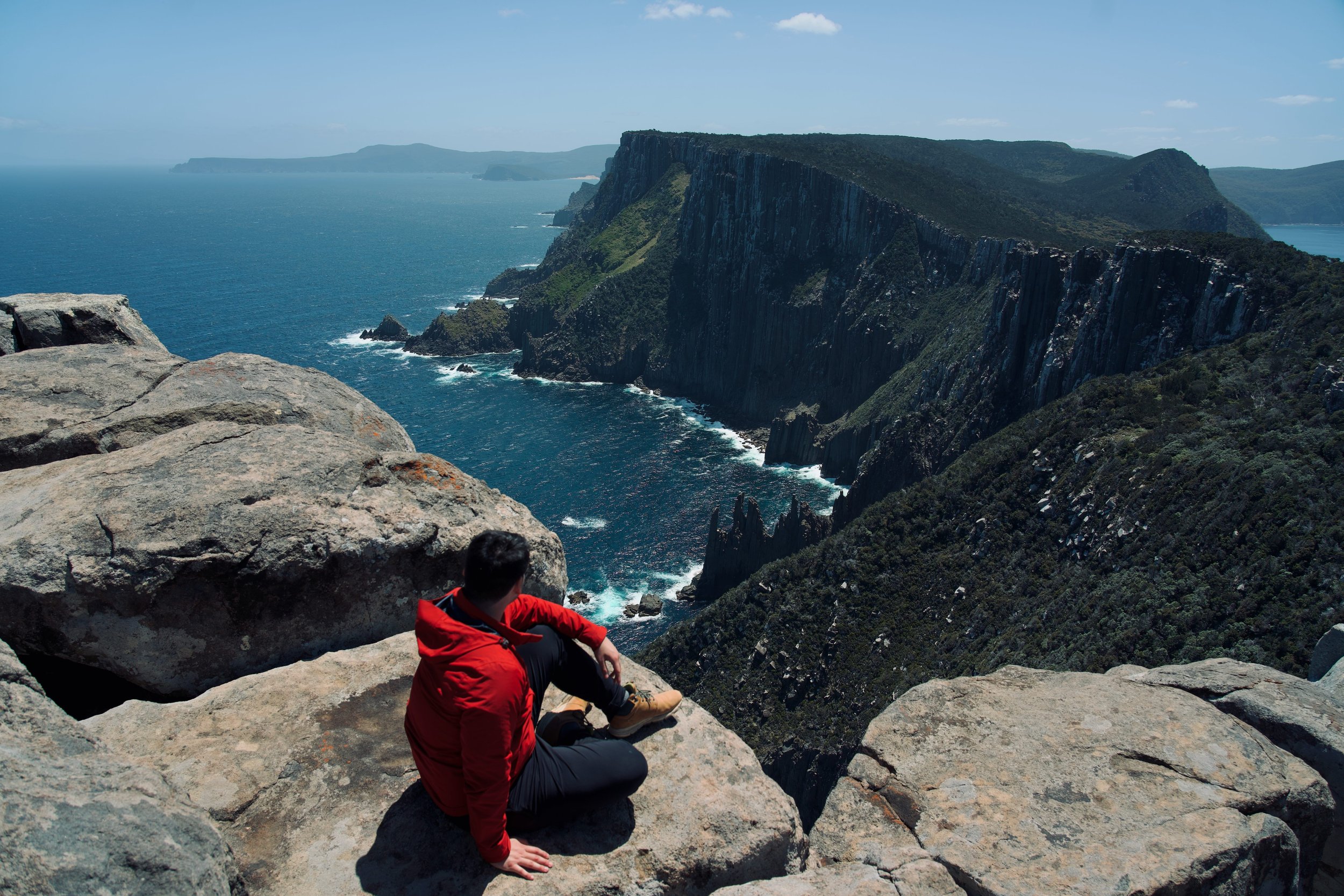
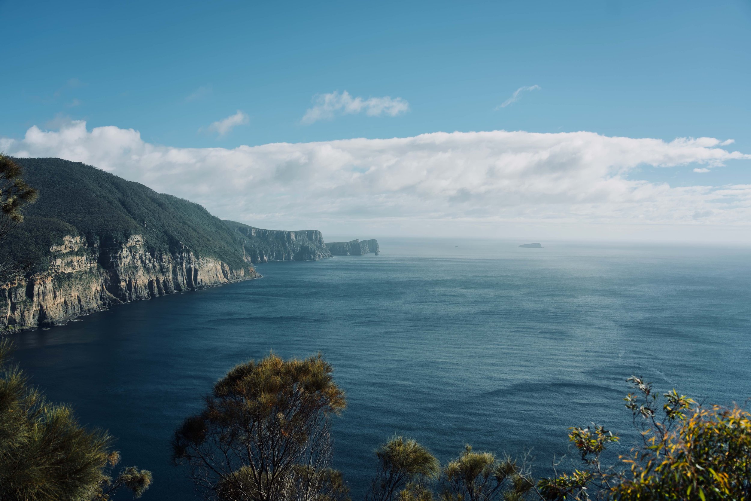
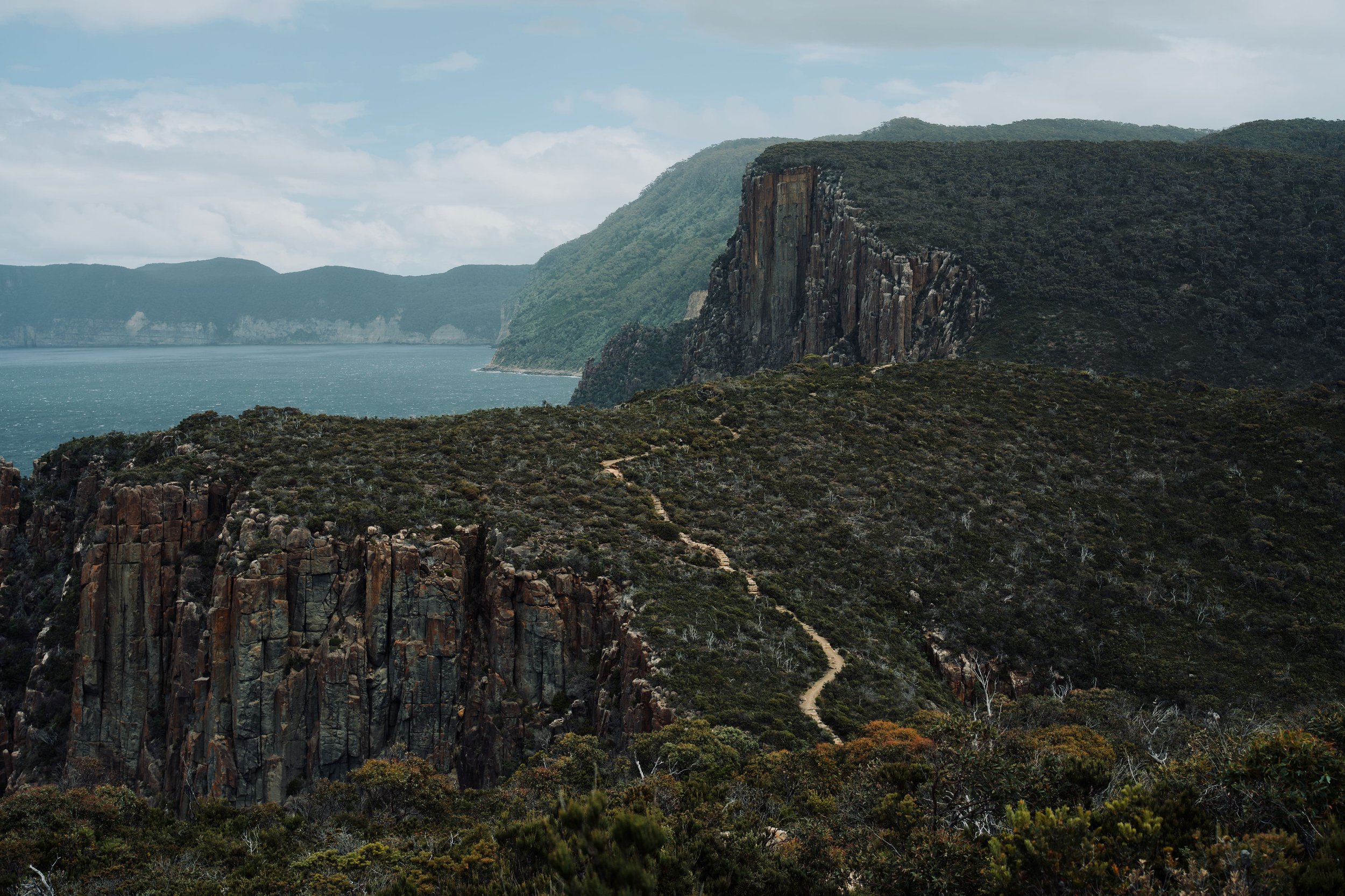
Day 3 is the most incredible day of the Three Capes Track. You’ll have unobstructed views of the Tasman coast for most of the trail, surrounded by geometrically formed dolerite cliffs and native Australian flora. Across the sea, you’ll spot Tasman Island and a lonely looking lighthouse—the view is perfect to meditate on.
It’s a short but steep climb to the top of the Blade (only maybe 3 minutes in total), and this section of the hike led to our favourite views of the coast and valleys of vegetation. Be careful at the top of the Blade and keep 2m from the edge. It can be easy to trip over the cracks of the rocky ground here, and it’s a steep 300m+ drop below (apparently the height of the Eiffel Tower). Further down the trail is Cape Pillar. It’s a slight incline to the top and the perfect place to sit and have lunch. To get to Retakunna Cabin, you’ll turn back and pass Munro Cabin again, and then it’s another hour or so from there.
We took about 9 hours on this day, factoring in photos, lunch, and time to relax and take in the views. Again, it didn’t matter so much. We started a little earlier at around 8:30am and reached Retakunna at about 5:00pm, with plenty of time to unwind before cooking.
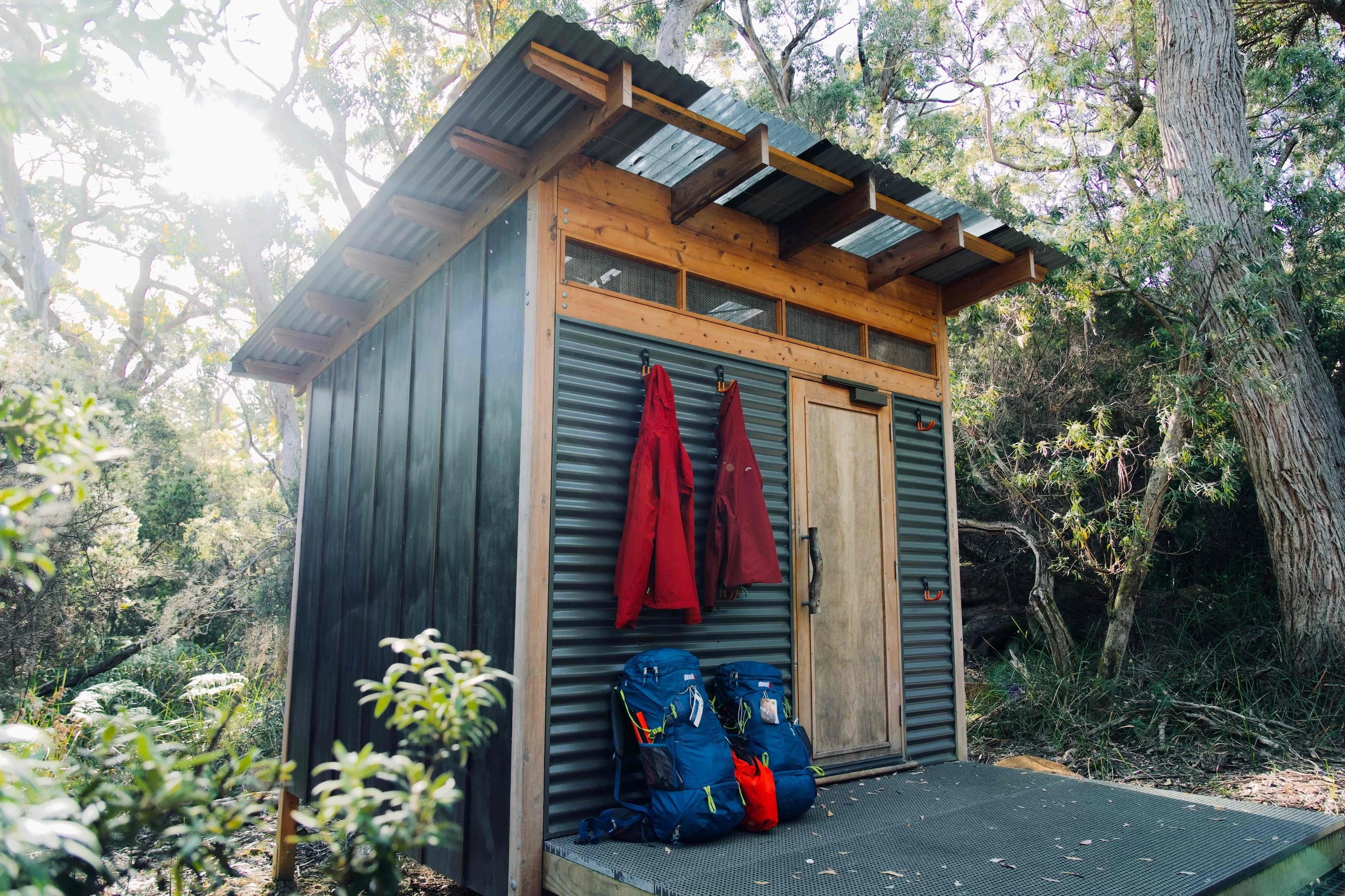
Cabin to store your hiking packs before starting the hike to The Blade and Cape Pillar, Day 3
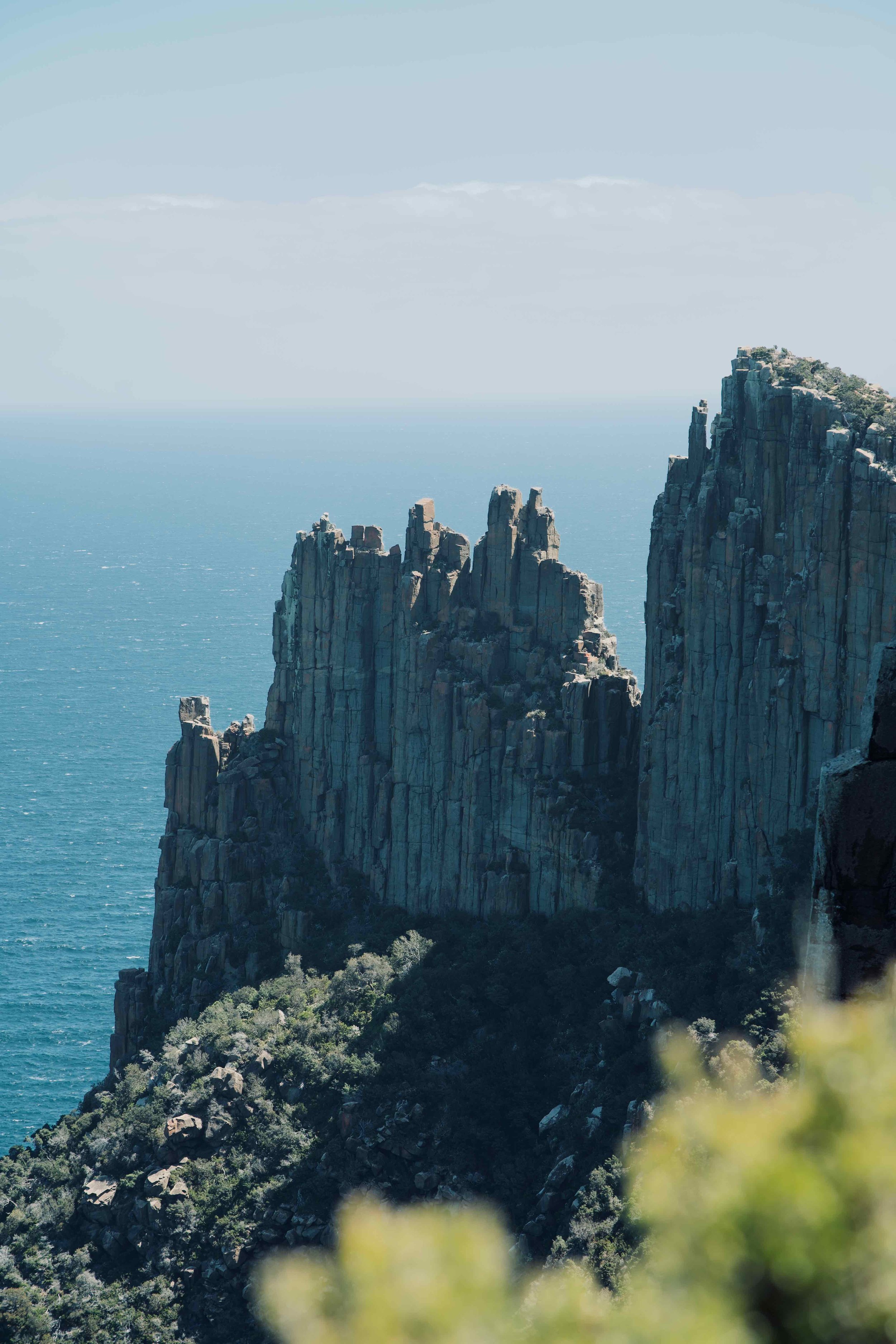
Dolerite cliffs on the hike to The Blade and Cape Pillar, Day 3

View from the top of The Blade, Day 3
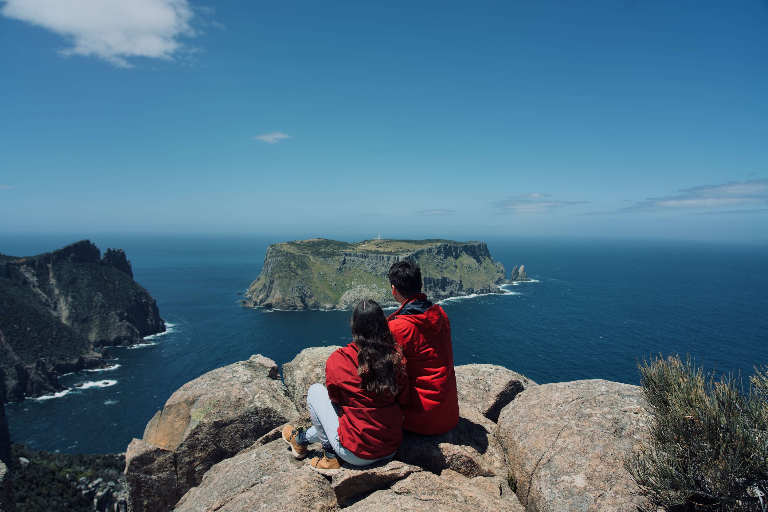
View of Tasman Island on the hike to The Blade and Cape Pillar, Day 3
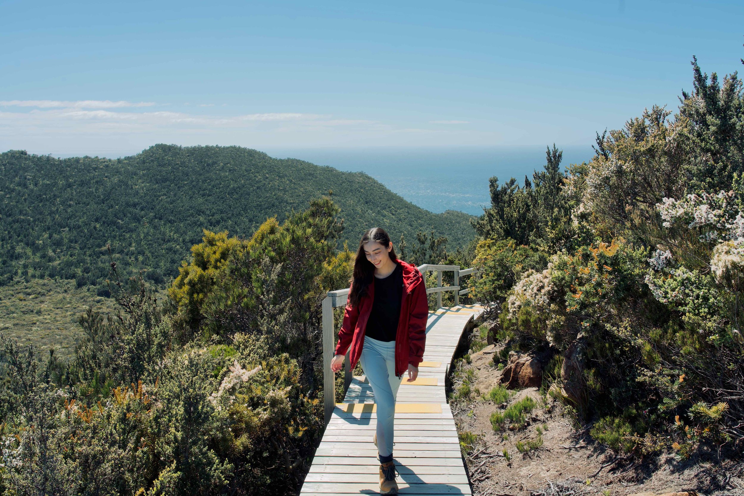
Boardwalk on the hike to The Blade and Cape Pillar, Day 3

Dolerite rock formations on the hike to The Blade and Cape Pillar, Day 3
DAY FOUR
RETAKUNNA CABIN TO CAPE HAUY TO FORTESCUE BAY
DISTANCE: 14km
TIME: ~6-7HRS
Retakunna Cabin is set in a stunning clearing at the base of Mount Fortescue. It’s a beautiful sight to wake up to, and you’ll be right in the thick of it on Day 4. It was by far the toughest day, with too many stairs to count on the climb up Mount Fortescue, and even more on the climb of Cape Hauy. It’s all worth it, as the sounds of a dewy rainforest are an extremely peaceful way to start the day, and the views on Cape Hauy an exciting way to end the four-day trek. If you’re lucky, you’ll also manage to spot some echidnas chasing ant trails on the track at Cape Hauy.
There’s a little enclave just before you start the Cape Hauy leg where you can leave your hiking pack. We’d recommend taking advantage of this because, again, there’s a lot of stairs. On Day 4, you need to be in the car park before the scheduled bus time (either 2:30pm or 4:00pm). Plan your starting time for the day around that, and if you feel you don’t have enough time for Cape Hauy (which may take around 60-90 minutes return), it’s okay to miss it as it is quite similar to the views on Day 3 and can always be done as a day hike from Fortescue Bay. We booked the later bus at 4:00pm, so we started the day at 7:30am.
As we made it to the beach in Fortescue Bay, we were overcome with gratitude for the chance to hike the Three Capes Track. It was our first ever multi-day hike, and we feel so enriched for having the experience. It has made us so excited to find more multi-day hikes in the future, all around the world.

Echidna on hike to Cape Hauy, Day 4

Hike to Cape Hauy, Day 4

Hike to Cape Hauy, Day 4

Stairs on the hike to Cape Hauy, Day 4

Dolerite cliffs seen on the hike to Cape Hauy, Day 4

View of Cape Hauy at the end of the trail, Day 4
PARTS OF THE THREE CAPES TRACK THAT CAN BE DONE AS A DAY HIKE
If you don’t have enough time or miss out on booking the whole Three Capes Track, parts of it can be done as a day hike from Fortescue Bay:
Cape Pillar (Day 3)—34km return—about 13.5hrs on AllTrails
Cape Hauy (Day 4)—10.1km return—about 4hrs
Day hikers usually park at Fortescue Bay and complete the return walks from there. We’re not sure if there’s a parking cost, but you are likely to need a National Parks Pass to enter the area.
The one-day hike from Fortescue Bay to Cape Hauy hike is the shorter option. We think the Cape Pillar hike would be more rewarding, but it would be substantially more difficult, and you would need to be well prepared. Whichever one you choose, always make sure you have enough food, water, sunscreen and protection from the elements.
OTHER WAYS TO SEE THE THREE CAPES
The landscapes around the Three Capes are some of the most unique that we’ve ever visited. The towering cliffs are really worth seeing, even if you don’t end up planning to hike the full Three Capes Track.
For other ways to see the area, these tours come with really high reviews:
Three Capes Panorama by seaplane: 1 hour 30 minute scenic flight over Hobart, Kunanyi/Mt Wellington and the Three Capes. It lands at Port Arthur as well to visit the historic site.
Wilderness and wildlife day trip from Hobart: a full day trip from Hobart with a three hour cruise around the Tasman peninsula to see the cliffs from the water, coastal waterfalls, and sea life like seals, dolphins, whales and sea birds. It includes a visit to Port Arthur historic site and lunch. This option also includes the Tasmanian Devil Conversation Park.
Wilderness and wildlife cruise from Port Arthur: 3 hour cruise around the Tasman Peninsula departing from Port Arthur.
End of the Three Capes Track at Fortescue Bay, Day 4
RECENT POSTS


PIN IT
Find us on Instagram